In September 2023, my investigations of the Asklepieion near Pergamon involved reviewing the material culture of the sanctuary.
While the aim of the 2021 season was to identify on site and understand the 18 different architectural layers identified by the excavators (see the blog ‘Tracing Walls’), it was now time to examine the material culture in closer detail. Our Deep-Map of the Asklepieion contains over 3000 items, all of which have been published, largely in the Altertümer von Pergamon series. While several inscriptions may be seen on site, just a few select items are on display in the Bergama Museum, so I was very fortunate to get to spend time in the depots, to now come to terms with the vast quantities and variety of material culture at the shrine, indicating the broad scope of activities that went on there, over a long temporal arc expanding from prehistoric times to the present. It was interesting to see the selection process, especially by Gioia da Luca, whose work at the time formed a benchmark for much of the subsequent work on Hellenistic pottery.
The amount of material was both exciting and sobering, as it quickly became clear that the material in our deep map is only a fraction of the material from the sanctuary! Nonetheless, this gives an indication of the many different uses of the shrine over time, as well as some of the hotspots. I plan to return next year to continue these studies.
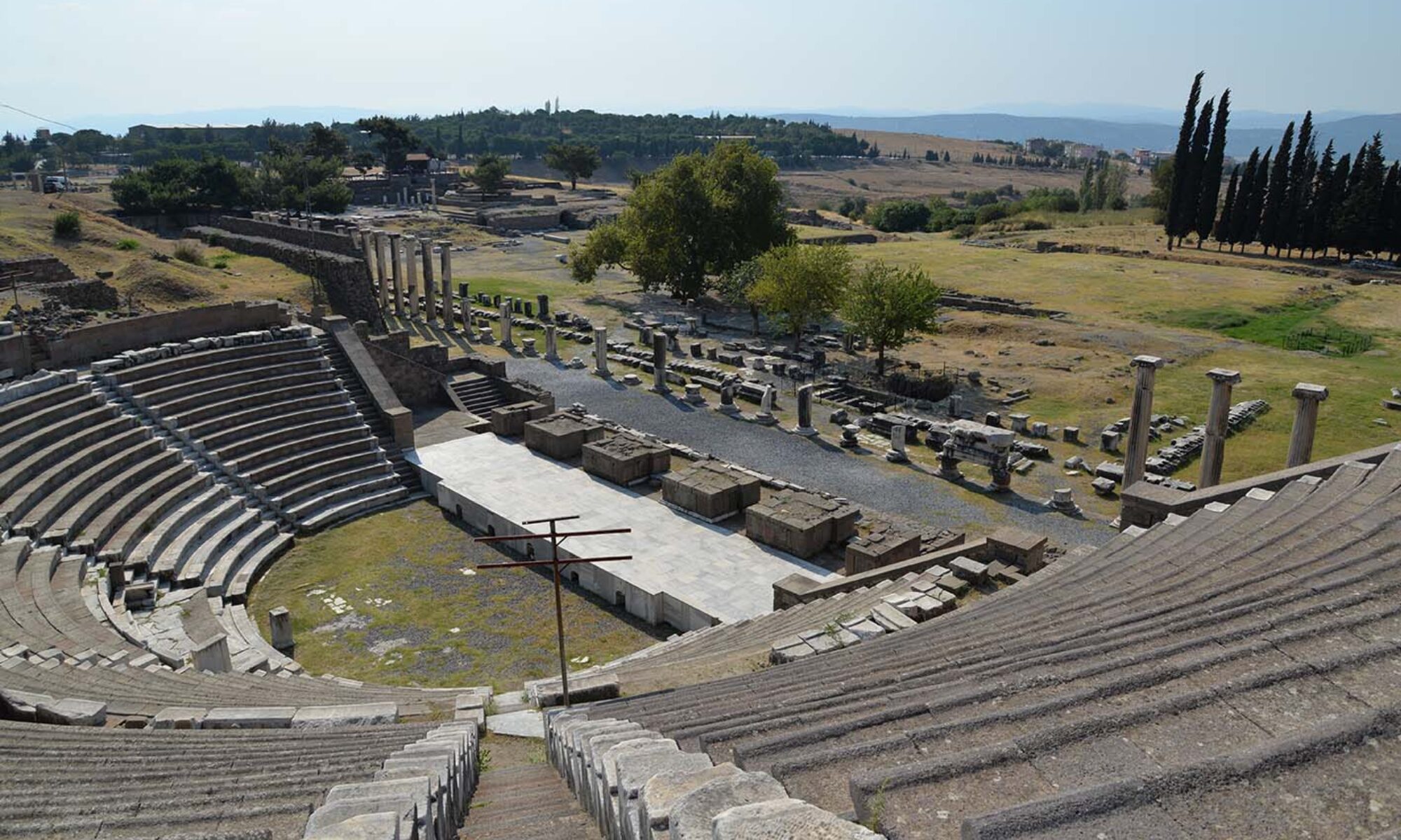
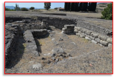
The central rooms of the Asklepieion, where ritual sleep presumably took place (photo cgw)
This fieldwork was possible through support from the project team of the DAI Istanbul, directed by prof.dr Felix Pirson, and with great help from Ulrich Mania, and the team of the TransPergMikro project. I am also grateful to the Max-Weber-Kolleg of the University of Erfurt, who provided funding through the project ‘Religion and Urbanity. Reciprocal formations’ (FOR 2779).
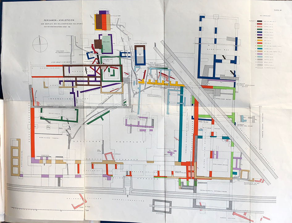
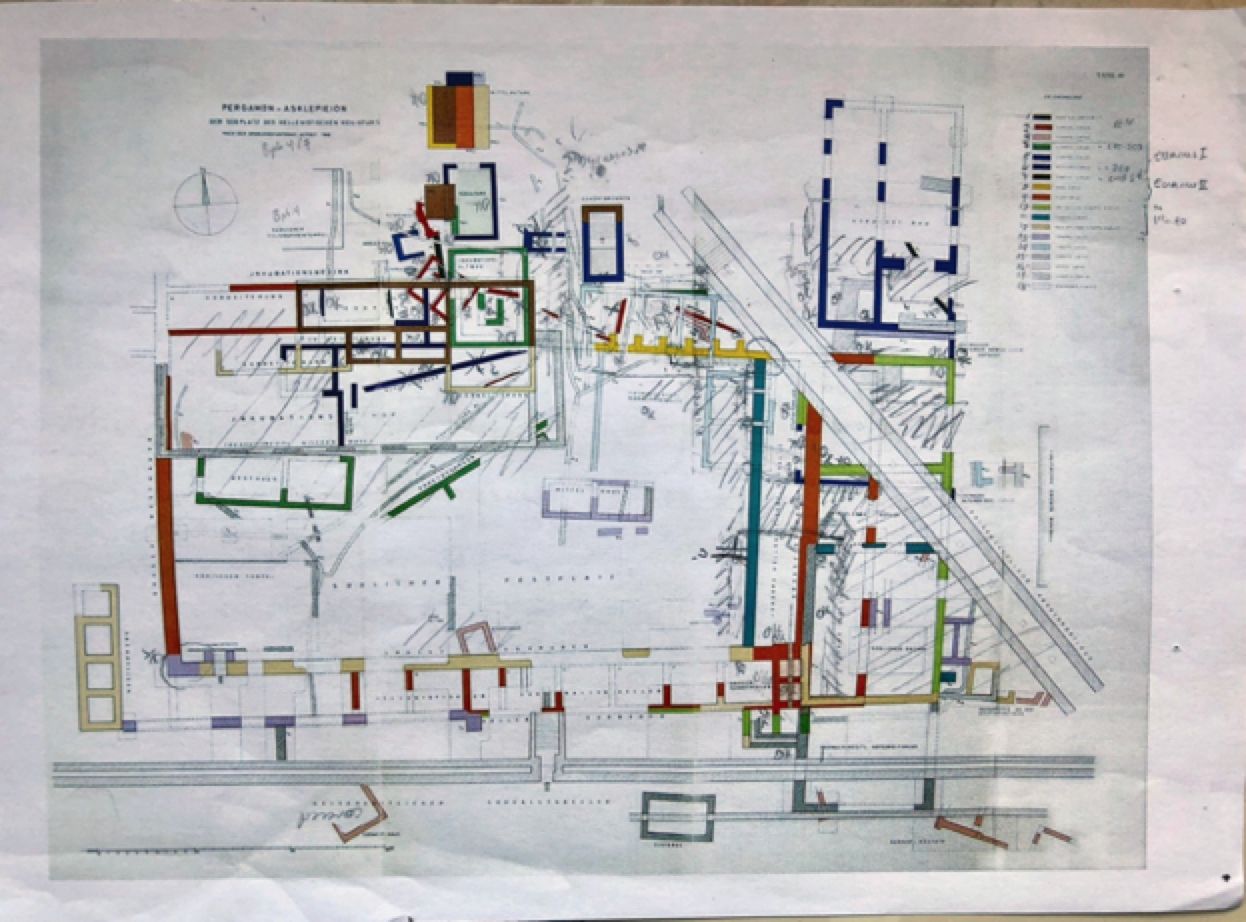
From 25 September to 3 October 2021 I was able to go on a research trip to Bergama in order to examine the Asklepieion in closer detail. The aim of this visit was to identify on the ground the numerous walls and structures that predate the grand imperial shrine of the second century AD (Shown here below, left). Some 18 constructions phases (Bauphasen) were identified in Altertümer von Pergamon XI.1, presented on Table 69 (below, right).
Asklepieion plan – Riethmüller 2012, Abb. 4AvP XI.1, Taf. 69
This is the plan that is generally used in discussions of the Hellenistic sanctuary
mapping the walls
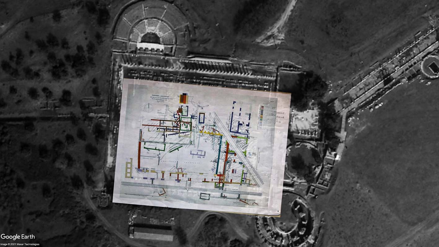
In practice, I both superimposed the plan on a satellite image, to roughly detect what could still be seen of the walls of the structures, since much of the surface area of the sanctuary is now covered by soil.
This helped in identifying the visible walls on the spot and connecting this to the different periods of the sanctuary. I also used photos from the excavation publications in Altertümer, which also gave an indication of the erosion that has taken place in the years since excavation – good thing that most of the walls are now covered up again!
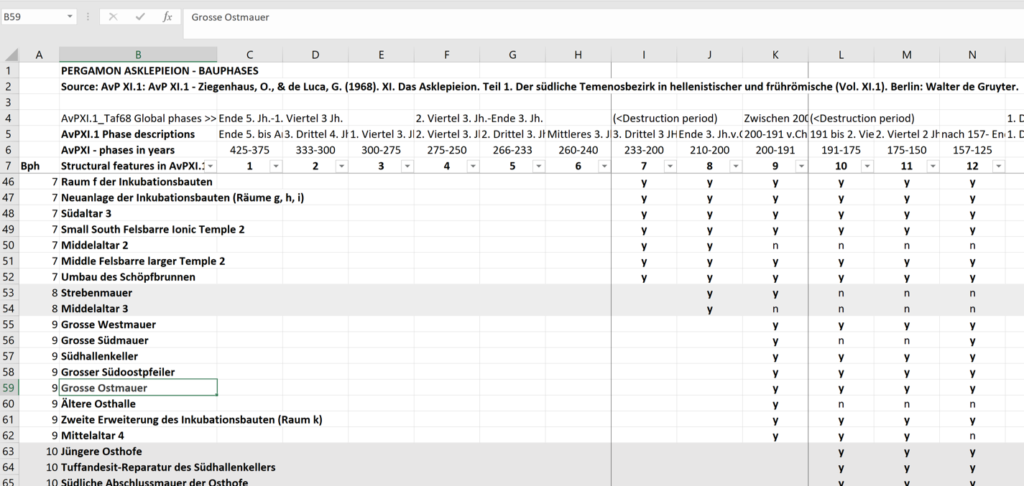
Identification of walls and structures in the building phases
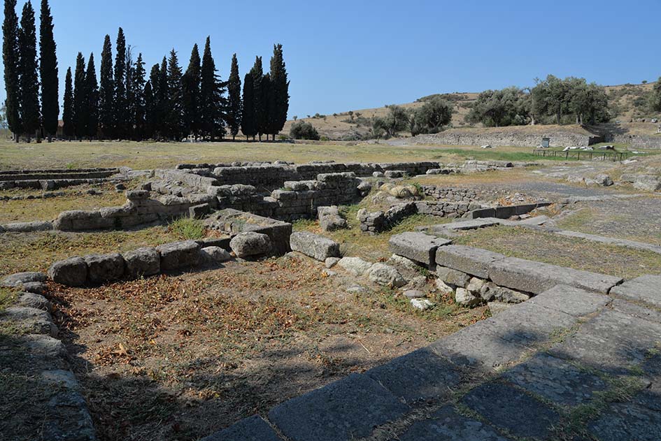
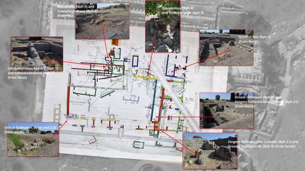
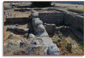
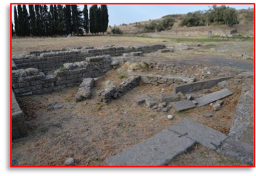
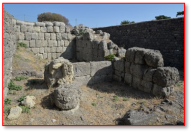
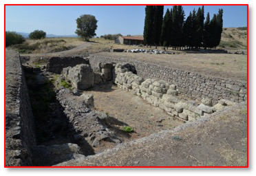
More impressions of the walls of the Asklepieion…
Inkubationsbau Raum G (Bph 7)and Schmalwandhaus (Bph 2)(from West)Grosse Südmauer, West end (13)(from South)Mosaikbau (Bph 5) and Schmalwandhaus (Bph 2)(from NE)Treppenbau (Bph 3)and Strebenmauer (Bph 8)Nordost Bau (Bph 5)(from North)Jüngere Hellenistische Osthalle (Bph 11) andGrosser Südostpfeiler (Boh 9) (from South)Grosse Ostmauer (Bph 9) and Jüngere Hellenistische Osthalle (Bph 11)(from North)A rough impression of some of the walls of the pre-imperial sanctuary and their building phases.
The result is a new, annotated working version of Taf. 69 from AvP XI.1, making it much easier for me to visualize the extent of the sanctuary in its landscape in the earlier phases and to understand its development.
AvP XI.1 Taf. 69 – working version
This sheet, and the photos, have helped us untangle the architectural complex, and its intricate chronologies. The excavators were primarily focused on the building history and its sequences, and so their understanding of the architectural development is literally the backbone of the chronology of the Asklepieion, at least in the temenos area, as almost all of the finds from the excavations were linked to the building phases of the walls that they were associated with, even though some individually date to an earlier or later period in time. This makes it all the more important to understand the temporal sequence of these construction phases.
Spreadsheet listing the structures and the building phases and periods in which they were extant.
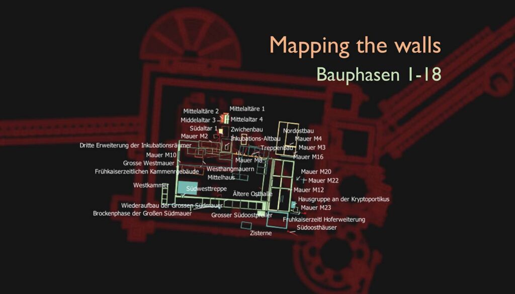
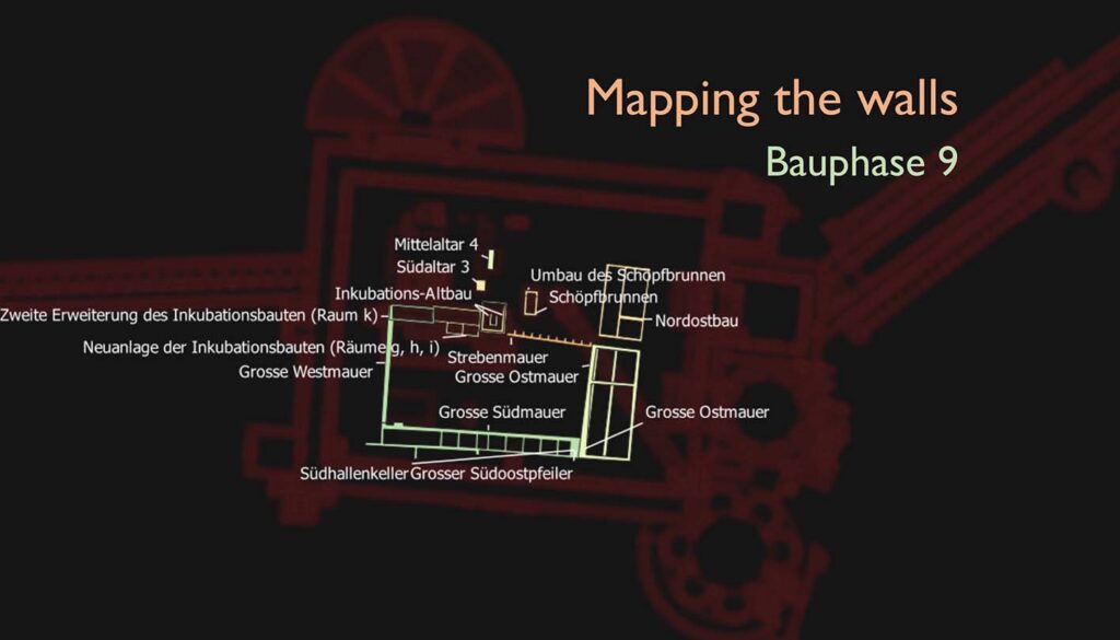
Based on this list, we can now get an indication of the periodization of the many structures in our GIS deep-map model of the shrine. This will make it much easier to run cross-analyses over time and space. Now we can decide whether we want to view the different periods of the shrine all together (below, left), or focus on a one or two phases (below, right).
GIS highlighting the walls, now with labelsGIS – showing buildings of Bauphase 9
The background image in these two figures is based on the Pergamon Digital Map shapefile of the Asklepieion, generously made available by the DAI on the TransPergMikro website.
I am thrilled to announce that this project has been selected as a winner for the highly competitive Spatial Data Call put out by the Geodienst from the University of Groningen. Their expertise in working with geographical data will give this project a significant boost and the support will be used in a pilot project:
Aelius Aristides – spatial narratives of the Asklepieion in Pergamon
Aelius Aristides, was a famous rhetorician and presumed hypochondriac in the second century AD who frequented the healing shrine of Asklepios near Pergamon, writing about his adventures in his Hieroi Logoi (The Sacred Tales). His work uniquely provides insights into the ‘total experience’ of a sanctuary, its rituals and divine encounters, and it includes several spatial references to places concerning the Asklepieion as well. The Hieroi Logoi is an invaluable source for positioning the sanctuary in its physical and social context. A challenge will be to geo-reference literary sources within a larger GIS environment, and so this pilot will also serve that purpose through a selection of relevant passages.
The Asklepieion near Pergamon (photo: CGW 2019)
After this pilot, other data sets pertaining to the Asklepieion will be integrated: architecture, inscriptions including multivocal testimonies of healing (dedications of gratitude) and even ‘graffiti’ where possible. The sanctuary is moreover a large repository of honorific and dedicatory inscriptions, some of which once held statues, and texts of cures from a variety of individuals.
Taken together, the Asklepieion provides a remarkable assemblage of sources rich in multi-vocal data across time, which this ‘deep map’ hopes to unlock. Stay tuned!